Hit enter to search or ESC to close

Survey of Distribution Network for Aerial Bundle Cable (ABC) Installation
About the
project
Surveying
ABOUT THE PROJECT
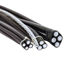 This project involved a comprehensive GIS-based survey, mapping, designing, and estimation of low-tension (LT) lines up to the consumer end to facilitate the installation of Aerial Bundle Cable (ABC). The scope of work included:
i. GIS survey of LT lines and consumer distribution transformers, collecting accurate pole-to-pole and transformer-level data.
ii. Preparation of maps in the GIS system, based on field survey data, to document the existing LT network and identify sections for ABC installation.
iii. Design and preparation of estimates for replacing existing bare LT conductors with 5-core ABC cable of appropriate sizes, ensuring improved safety, reliability, and efficiency of the distribution system.
This project delivered precise GIS-ready data, detailed network maps, and actionable design estimates to support the successful implementation of the ABC deployment program.
Let’s find out how to work together
Ready to start your project? The contact information collected through this form will only be used to send a response to your inquiry.

© 2026 GeoSky